Kashmir Great Lakes Trek (KGL) has been on my bucket list for many years. It is known as the most beautiful trek in India, definitely one of the most popular. After lots of research and prep work, finally did the trek from July 29 - August 4 this year, along with four of my hiking buddies from the Bay Area. It was a dream come true - spectacular hiking with wonderful friends!
The trailhead for the KGL trek is near Sonmarg. We carried only small daypacks during the 7-day trek. All supplies and luggage are carried by mules/horses. We had a support staff of 6 (guides, cook, etc.) for our private group of 5 hikers.
Under overcast skies and the fog rolling in, we hiked past these shepherd huts at 9000 ft. These huts are used only in the summer months by the Kashmiri Gujjars (gypsies).
A few hours into the hiking on the first day, we had a heavy downpour and the raingear came out.
The locals were happy to see the first decent rainfall after a dry spell of 2 months. An auspicious start to our trek.
Perfect spot to relax after our packed lunch - Kashmiri roti and spicy sabzi (mixed vegetables).
Campsite for first night at Nichnai, elevation 11700 ft. There are three tents for the 5 of us, plus the blue dining tent and the kitchen tent behind it. The two toilet tents are to the right of us. The porters and mules reached the campsite a couple of hours ahead of us and set up everything and had hot kahwa (Kashmiri tea) ready for us. Fast flowing creeks surrounded us on both sides.
The view looking out from our tents at the Nichnai campsite. The picture-perfect setting set the tone for the coming days ....
Day 2: Taking a short break after a steep uphill section. Hiking today from Nichnai (11700 ft) to Vishansar (12000 ft), going over Nichnai pass enroute at 13400 ft.We started hiking at 7am on our 2nd day of the trek, which is later than our guides had wanted  .
.
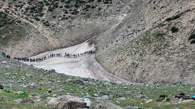
The horses/mules train, crossing the Nichnai pass. The guides recommend an early hiking start each day in part to avoid the rush.
The blue tent is a dhaba, a welcome sight at this remote 13400 ft location. Good place for a break and to get some Kahwa, snacks, cold drinks and of course "Pahadon Wali Maggi".
After crossing the pass, the downhill stretch allowed us to enjoy the scenery at a relaxed pace. Rocky mountain peaks, glaciers and snow patches, lush green meadows, wildflowers, ....
Beautiful flowers and green meadows as far as the eye can see.
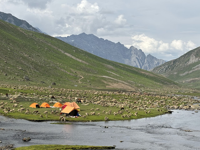
Early in the afternoon, reached our campsite for the 2nd night. It is very close to Vishansar (the first great lake on the trek).We were greeted by this sight of hundreds of sheep on the other side of the river from our campsite. They had run down the mountain side in a big cloud of dust. Within 10 minutes, they had all moved on to greener pastures 
After a 10-minute evening walk from our campsite, our first sighting of Vishansar. It is surrounded on 3 sides by tall mountain peaks and patches of snow. The wind was blowing hard, so no reflection in the water.
From our campsite, enjoyed the sun setting over the mountains and into the clouds.
Day 3: An earlier start to the day. Left the campsite at 6:10am, after a quick glance at the rising sun behind us. We have a steep climb to Gadsar pass, the highest point of the KGL trek at 13800 ft.All five of us are feeling quite good with no signs of AMS (acute mountain sickness) after two nights at 12k. The months of training hikes in USA, acclimatization hikes in Aru and a few days of taking Diamox are doing the trick. We are ready to tackle the 13.8k Gadsar pass.
A few minutes into the hike for the day, we go past Vishansar. The lack of wind, the morning light, beautiful reflections make for a mesmerizing sight.
Our whole group along with two guides posing in front of Vishansar!
As we climb the steep mountain trail, can't help but stop and look back down at Vishansar every few minutes as it recedes in the distance.
After we climbed a few hundred feet higher, Krishansar, the higher-level lake, revealed itself. Can't decide which lake is more beautiful - Vishansar or Krishansar. Loved them both!
Reached Gadsar pass by 9am and celebrated reaching our highest point of the trek. The weather was very pleasant, wonderful blue skies and bright sun.
Iconic view of both Vishansar and Krishansar together from the top of Gadsar pass.
Nothing like a 5-minute micro nap to rejuvenate the body and spirit.
After crossing Gadsar pass, we were rewarded with a gradual downhill stretch, through meadows full of bright flowers and small lakes on the left side.
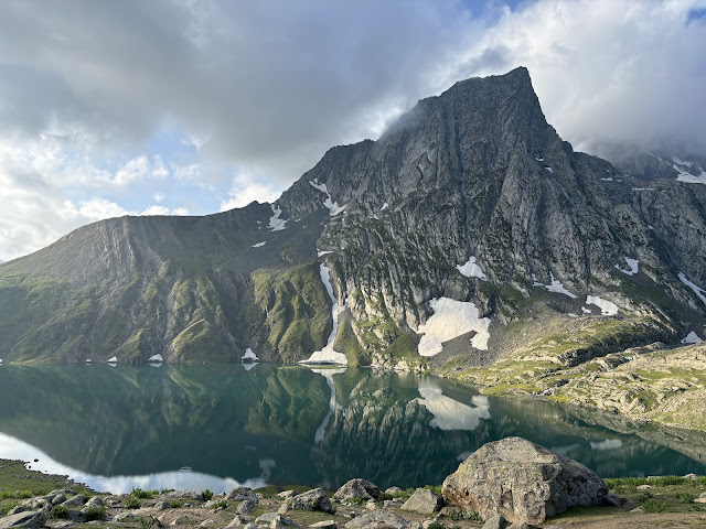
Around noon we reached Gadsar, the highlight of the day and maybe the prettiest lake of KGL. The snow clad cliffs reach down to the lake shore, numerous small icebergs break away into the lake, lots of waterfalls rush down from the glaciers into the lake. The turquoise lake is a feast for the eyes, with the sun and clouds creating many shades.
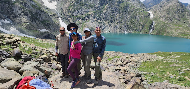
Posing on our favorite rock near Gadsar. We stayed here for an hour - had our packed lunch here, oohed and aahed over the lake and surrounding mountains, took a group micro-nap, posed for lots of pictures. It was hard to leave ....
Lots of small waterfalls streaming into the lake from the melting ice and snow.
The creek flowing out of Gadsar. Small icebergs visible in the lake.
After leaving Gadsar, we still had to hike several miles to reach our campsite of the day at 10700 ft. On the way we had to go through an army checkpoint where they verified everyone's identification. We are less than 30 miles from the LoC (line of control) with Pakistan.
Day 4: Hike from Gadsar campsite to Satsar (seven lakes). A late start of 7:45am from the campsite for us. Note the stream of other trek groups already on the trail. The first thing for the day is to cross the snow bridge over the river followed by a steep scramble up the mountain side. No pass to cross today, but still elevation gain of around 1700 ft since Satsar is at a higher elevation of 12k.
Beautiful canyon view with multiple shades of green and the river flowing at the bottom. The weather is turning gloomy with dark clouds in the sky.
It started raining and we look shelter in this dhaba for a while. Enjoying hot Kahwa while we wait.
In the light drizzle we donned our matching raincoats that we had purchased in Sonmarg. They looked good but failed to keep us dry when we hiked for a few hours in heavy rain later in the day.The K2 peak is supposed to be visible behind us but is hidden in the clouds.
Scrambling over these slick, slippery rocks in heavy rain and fog made for a miserable time. We were all cold and wet and couldn't wait to reach our elusive Satsar campsite.
Finally made it to our campsite and quickly huddled into the dining tent with the rain pounding outside. Getting rid of our wet raincoats and some hot tea revived our spirits. Once it stopped raining, we took our bags to our tents and changed into dry clothes.Later in the evening, walked back to some of the lakes of Satsar (seven lakes) group and took some sunset photos.
With the rain and fog gone, the tents for the various trek groups made for a pretty sight in the evening. None of this was visible earlier in the day, when we stumbled our way to the campsite in the rain and fog.
The moon shining between the clouds and behind the mountain was an interesting light effect in the night sky.
Day 5: Blue skies greeted us in the morning as we got ready for the hike from Satsar to Nandkol and Gangbal. We have to cross Zaj Pass at 13500 ft on the way. The initial mile is hopping over large boulders made slippery from the previous days rain.In this pic, we are taking a break celebrating getting past the big boulders.
At the top of Zaj pass, a beautiful view of Mt Harmukh (16870 ft) soaring above the clouds. The twin lakes of Nandkol and Gangbal are partially visible between the clouds.
Celebrating as a group on reaching the top of Zaj Pass. It is the last pass we cross in the KGL trek. It is mostly downhill from here ...
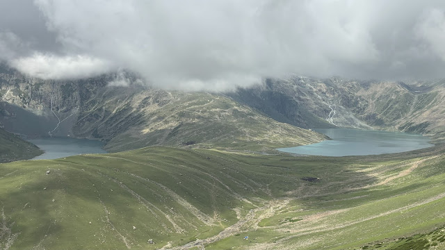
The clouds have parted long enough to reveal both the Nandkol and Gangbal lakes behind the beautiful green meadows. Still a long way down to our campsite at Nandkol.
Time to take in the gorgeous view and pose for a group pic as we approach Nandkol. A small downhill stretch remains before we get to our campsite for 2 nights.
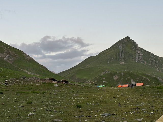
Almost there. Tents of different trek groups are visible. By now, we can recognize some of the trek companies by the color of their tents!
The Harmukh glacier hangs precariously in the steep cliffs above Nandkol. The rain cascading down the cliffs glistens as the sun pokes through the clouds.
Day 6: Buffer day that we are using at Nandkol. We are staying here 2 nights, resting, recovering and getting ready for the brutal downhill hike on the last day down to Naranag.A lazy start to the day after a late breakfast. A short 2 mile hike to Gangbal from Nandkol involves crossing the big stream that flows down from Gangbal to Nandkol. The guides are lending a helping hand as we walk barefoot through the water.
Made it to the other side of the stream and the banks of Gangbal, which is the largest lake by far in the KGL trek.
The Shiva rock temple on the banks of Gangbal.
Mt Harmukh and the Harmukh glacier as seen from our campsite at Nandkol. It was fascinating to see this imposing sight off and on for two days, when it emerged after being hidden for hours in the clouds or fog.
Sunset views from the Nandkol campsite.
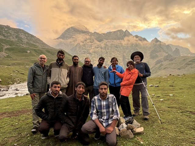
The whole gang - our group of 5 hikers from the USA along with the 6 local Kashmiris who facilitated our trek, guided us, fed us and made it a fun, safe experience overall.
Our last candlelight dinner in the dining tent. Looked forward every evening to the simple, delicious, hot food after a long day of hiking. Will remember fondly our long conversations, the singing and Antakshri sessions, the daily briefings to plan for the next day!
Day 7: Had to cross the fast-flowing stream over this narrow plank on our last day of the trek as we hiked from Nandkol to Naranag. No problem if you take it slow and don't look down into the water too long.
Taking a break during the hike through this beautiful meadow on the last day of the KGL trek. It was a steep downhill hike, going down over 4500 ft in 8 miles. The trail was muddy and slippery from the previous days rain. Most of us lost our footing or slipped somewhere along the way and got mud all over our hiking boots and pants.
Proudly showing off our muddy boots during a stop at Maggi Point, a dhaba half-way between Gangbal and Naranag.
Made it to Naranag, the end point of our KGL trek. This is the famous Shiva temple archeological ruins in Naranag. They date back to 8th century AD.Celebrated the successful completion of the KGL trek and took away lots of memories of the fun, intense experience.
Daily hiking/walking stats from my iPhone. This includes the hike from one campsite to the next plus walking/exploring at each campsite. Over 7 days, hiked 50 miles with total elevation gain of around 12000 feet.I also mapped the hiking each day using AllTrails in the following list:https://www.alltrails.com/.../kashmir-great-lakes-kgl...














Comments
Post a Comment